Hot Creek Road


hotcreek.jpg

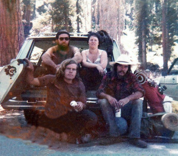
I first visited Hot Creek back sometime in the 70’s. It was not the place to take the family back then, but a “hot” spot for party goers. Swimsuits were optional, but rare, and there was not much in the way of advertising its location to visitors. I went back years later and although the creek is much the same, the National Park Service, or maybe the Forest Service now maintains the area, and it ratings have gone from ‘AO’ adult only to ‘G’ General Audiences, all ages admitted.

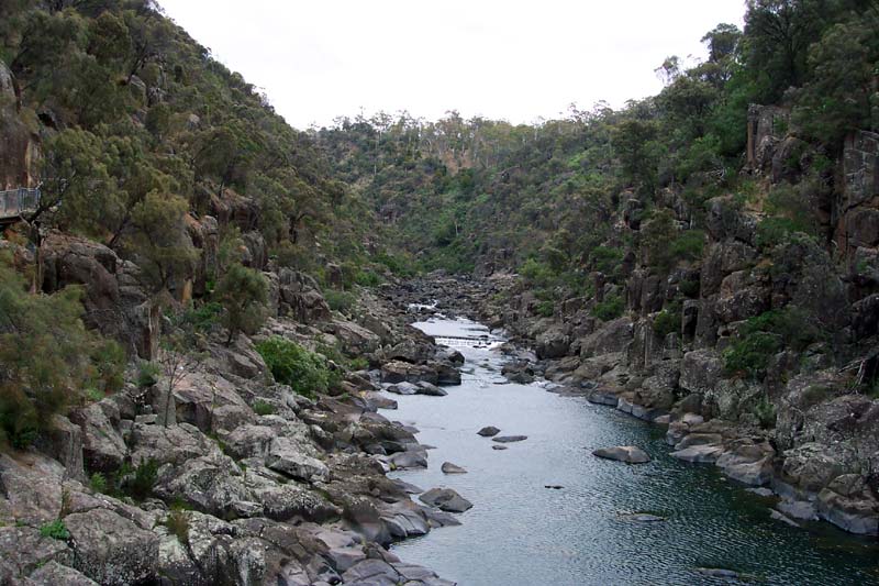
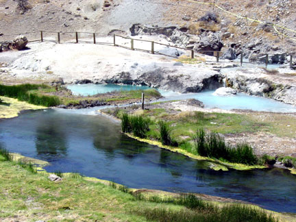
Finding Hot Creek is much easier now also. Hot Creek is 25 miles south of Lake Mono, near Mammoth Lakes. It’s located two miles south of the Mammoth Lakes turnoff from route 395, turn left onto Hot Creek Airport Road and follow the signs for about three miles. There are two bathing areas, one at the bottom of the trail that leads down from the parking lot. Continue along the trail and you will arrive at the second, just slightly less popular, but just as good.

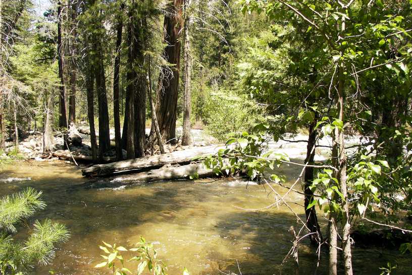
The waters are unique as the hot water bubbles up from the bottom of the creek, where the waters are heated by magma three miles below the surface. This hot water mixes with the cold creek water, and with a few adjustments, you can find the perfect mix.

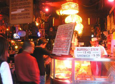
If the creek is crowded, there are also a number of natural and man-assisted hot tubs in the valley below Mammoth. Most all are well-known — almost all of the tubs are described in a guide book, so if you find one that doesn’t have someone sitting in it already, it’s not that you’ve discovered anything rare, you’re just lucky. Most are small, so when 50 people show up it’s time to drive back down route 395 and head for Grumpy’s Bar or the Whiskey Creek Mountain Bistro.

King’s Canyon

kcsc.jpg

It wasn’t that we didn’t want Barbie to come, we were more concerned about her health, she wasn’t ready to make a walk around the block let alone the 5 day backpacking trip we were going to go on. Shelley, her sister, wasn’t ready either, but she was Stan’s wife and he knew if we didn’t let her come along, than five days from now when we got back his life would be miserable. The next 5 days might not be easy, but after weighing the two options, he figured not bringing her weighed alot more than leaving her behind. The night before was preparation and packing. Five days out created some pretty heavy packs and it was understood that although Becky and Shelley carried less, everyone needed to carry their load.

Leaving early a.m. we arrived at Sequoia in time to set out, or rather ‘up’ as our trail led uphill immediately. Problem #1 began with the car still visible not too far below us. Shelley was exhausted. She was actually a shade of pink that did give credence to her complaining that she needed to rest…but I can still see the car below…we’re headed three days in and we’ve only been hiking about 15 minutes! After a break, we struck out again only to make it another half hour before Shelley was complaining about the pack. It was too heavy, it hurt her shoulders, it was…Holy Shit, O.K. Shelley…we’ll pull out as much as we can and put it into Stan’s, Patrick’s, Beckys, and mine. O.K.??? Let’s go. That worked for nearly two hours until the climb got steeper and Shelley need to stop for the umteenth time complaining about
the pack. Bloody Hell, Shelley…and we hooked the pack onto Stan’s other pack.

First night out – dinner time. The freeze dried dinners did not meet with Shelley’s standards and so she wouldn’t eat without the threat that we were going to leave her tomorrow on the trail. Just great.

Day two – Stan sprains his ankle, swells up bad. We try to empty his pack(s) into the three of ours to lessen the weight, but he was in pain. I think the pain in his ankle was replaced by the pain in his ears and alittle aggrevation as Shelley moaned and groaned with every step she took.

Second night out – we had been warned about bears and had hung the packs high up over a tree branch. We were sleeping along a large meadow, thinking about the bears, listening to the sounds around us that we thought might be bears, but turned out later to be nothing more than little creatures scampering about. We know that now because either later that night, or early in the a.m., we all woke to the crack of a log across the meadow. That was a bear.

Day three – The photos I took show reflections of the mountains in a lake so clear that it’s not easy at first to know whether the photo is right side up. We had brought fishing poles, broken down to fit in special backpacking tubes. Thinking that the advantage was all ours, we soon discovered that either no fish existed in this lake, or the lures we brought were worthless and we needed to find a bait that the fish dined on. There were alot of little frogs along the shore, and after drowning a couple without even a bite, another idea hit us that required we catch alot of them. The plan was to put them all in a pot, heat ’em up alittle to get them active, call Shelley over and ask her to take off the lid to the pot and ‘Hello little frogs’ – 30 to 50 of them jumping out as high and fast as they are able. With hot feet and a fear that we were French, they were trying to get out of that pot any way they could, through the lid if possible, so we had to put a stone on top to keep them all in for their ‘welcome’ to Shelley. At the last minute we thought that if she had a heart attack, we’d either have to pack her out, or bury her near the lake. Nobody willing to carry her, and no shovels to dig with, we decided to scap the idea which only added to our fustrations with Shelley. Just to put her on edge we told her of our plan. She seemed to complain less during the day, but I imagine she didn’t sleep too well, keeping one eye open, unsure whether we had a Plan”B” that we hadn’t mentioned.


Day four – We revisit the frogs in the pot idea. We wonder what we brought along that would dig a large hole.

Day five – Back down the mountain, back at the car. First priority to get a six-pack of beer from the store at the campground. With the station wagon back folded down, a cold beer in hand, looking up at the mountain we’d climbed over,…Shelley says “that was fun, when are we going to do this again?”.

If we don’t look happy, it’s only because after Shelley’s comment, Stan, Patrick and I were all thinking that maybe the frog idea was an opportunity now lost.


Cataract Gorge

cataract_gorge.jpg

When the Olympic Games in 1956 where held in Melbourne, Australia, no map showed Tasmania, the black sheep state. I was once told by a Melbourne mate that Tasmania is the state where men are men and sheep are nervous…or was it that the women looked like men…but however he said it, I do remember the part of the sheep. He often referred to the people of Tasmania in a way which gave more credit to the sheep than the shepherd.

After having their 11th child, a Tasmanian couple decided that was enough, as they could not afford a larger bed. So the husband went to his doctor/veterinarian and told him that he and his wife/cousin didn’t want to have any more children. The doctor told him that there was a procedure called a vasectomy that could fix the problem but that it was expensive.

A less costly alternative, said the doctor, was to go home, get a firecracker, light it, put it in a beer can, then hold the can up to his ear and count to 10. The Tasmanian said to the doctor, “I may not be the smartest man in the world, but I don’t see how putting a firecracker in a beer can next to my ear is going to help me.” “Trust me,” said the doctor.

So the man went home, lit a firecracker and put it in a beer can. He held the can up to his ear and began to count:
“1”
“2”
“3”
“4”
“5”
at which point he paused, placed the beer can between his legs, and resumed counting on his other hand.

Enough said, I did add Cataract Gorge just outside Launceston to the must see list. That’s not really saying much as most of what I saw were sheep, a hell of a lot of sheep, four legged lawnmowers. There is also a casino I visited, but it ain’t mutton compared to Vegas.

Russian River Resort

pool_1954.jpg

The photo is of the pool at the Russian River Resort, 1954. I think a lot has changed since then, although there is still a pool, the guests today are predominately gay and lesbian. Unaware of any of this and in need of a room for the night, the triple R looked as good a place as any. The sign on the office window directed us to the bar, and our heads still cloudy from the night before, we noticed nothing that would indicate the triple A probably didn’t list the triple R in their guide for places to stay.

We were shown to our cabin, a walk from the bar along the pool. Looking back on it now I’m glad it was winter and the pool was empty of um, frolickers. The image of one guy sitting atop another guys shoulder tossing a beach ball was not one I want to have. At any rate, there we were, cabin #3, just relax for a moment, read the brochure and see what there is to do in Guerneville. WHAT THE HELL? – didn’t even finish reading the first paragraph of the brochure! Tossed-it over to my friend along with the keys to the car where our bags were still. “You go get them.”, “No, you.”, “No, you.” Shit, we’ll both go…don’t look up, don’t make eye contact. Just walk out, along the pool, past the bar, past the office, out the gate and to the car. With Buck Jr. holding his bag behind him pleading “protect me bum, mate”, something in black leather passed us but I only saw the leather pants and boots, my eyes focused on the ground, it was a wonder that either of us looked up to see which cabin number we were stopping at.

Actually a peaceful, restful stay. We didn’t return to the bar at the triple R, but instead headed to the bar at the Union Hotel in Occidental for drink and Italian food. I can’t recall if a condom on the pillow replaces a chocolate, and it’s a safe bet that I’ll never return, but all in all, at least that night, it was a restful stay. I give it a Three Star Triple A rating.

star2.jpg star2.jpg star2.jpg

Isla Vista

bofa_burning.gif

Isla Vista is located adjacent to the University of California Santa Barbara [UCSB]. A one square mile town consisting primarily of apartments, a few businesses and a population of over 20,000. Isla Vista was considered by many to be second only to Berkely as a hotbed for political activism, and first came to national attention during the protests of the Vietnam War. The image above is a poster made from a photo of the burning of the Bank of America. Isla Vista first came to my attention as a teenager when I discovered that while only in junior high school, I could walk into a keg party, held nearly every weekend, at one of the frat houses. That eventually added up to spending a long, cold night on the beach without the luxury of a jacket, but theonly other option offered from the local police was to be taken in custody. They really didn’t want to bother with paperwork and told us to just leave Isla Vista. Without car, 2:00 in the morning…where else could we go?, except of course with the kind officers for a ride to juvenile hall. That ride would come a couple years later. For the next few years it was a regular hangout, playing pool late night, and hanging around the beach throughout the day.I lived in Isla Vista on three separate occasions, my first apartment out of high school, and two more times for summers when the town wasn’t so crowded and when the law changed allowing Isla Vista to sell beer and wine, and I was at an age to legally purchase it. Passed out on my dog was taken the summer after high school, and is a pretty accurate representation of what that summer was like. My buddy Hugh and I first moved to Isla Vista for the summer just before heading to college. Hugh worked at an electronics firm and I spent days playing pool at the UCSB Student Center with a transplant from Boston. We both were pretty good and soon found that hours of practicing straight pool daily was beginning to be less challenging. Moving our rack to the snooker table our aim had to be dead on, the table was both wider and longer and we were using oversized balls for the size of the snooker pockets. At first, for a few days that is, our shots rattled around the pockets but not dropping in. By day four we were on track. After a week of straight pool on a snooker table we were good, and after moving back, the tables looked like the little quarter a game tables found in bars. We were dead on and won a number of small bets with players who thought they were the next Fast Eddie. We took on and beat all comers. I never hustled pool, but I grew up with a table in the house since I was in the seventh grade and could usually hold a table at the bar until bored or blind. I can’t say the the same for hustling my friend Hugh when it came to chugging beers. Hugh’s weakness was not being able to back away from a dare, or the idea of losing in competition. The chug a beer contest started one night… hold the beer can upside down with mouth wide open and pull the pop tab. Glug, glug, glug – however, as simple as it sounds I never thought I could beat Hugh, nor did I ever once try. I simply reached down and grabbed an empty, there were plenty around, and out of the corner of my eye watched Hugh… just before he thought he crossed the finish line first, I crushed my empty can, filling Hugh with another 12 oz. of disappointment. The second chug was usually by my coaxing, but the third was definitely Hugh’s futile attempt to pull out a victory before staggering down the hall talking to himself. This continued for a couple months but there was change, Hugh was getting faster. I barely had time to reach down and grab an empty, he was really fast, really, really fast. I placed money on Hugh on more than one occasion and never did have to pay out.

I Madonnari

Street painting, using chalk as the medium, is an Italian tradition dating to the 16th century. Called “Madonnari” because of the practice of reproducing the image of the Madonna (Our Lady). The Madonna was the most reproduced artwork. In Italy, the tradition lives on in the village of Grazie di Curtatone, where the International Street Painting Festival is held in August each year in front of the Catholic church. The early Italian street painters were vagabonds who would arrive in small towns and villages for Catholic religious festivals and transform the streets and public squares into temporary galleries for their ephemeral works of art. With the first rains of the season, their paintings would be gone. On the plaza of the old Santa Barbara Mission “I Madonnari” Italian Street Painting Festival takes place every year in May for three days.

After traveling to the festival in Italy, Kathy Koury produced the first-year event in 1987. In this year, the Santa Barbara Mission was celebrating its bicentennial. Father Virgil Cordano and the bicentennial committee members agreed to accept the street painting festival as a part of their celebration. From that time on, the festival has continued to grow and now is being replicated in other cities throughout the U.S.

Squares are drawn in a grid on the pavement in front of the Old Mission, dividing the plaza into 150 squares. The squares range in size from 4′ by 6′ to 12′ by 12′ and in price from $100 to $500, each one bearing the name of its sponsor, which can be a business, organization or individual. As the public watches, local artists then fill these pavement canvases with imagery, often elaborate compositions in unexpectedly vibrant colors.

In another part of the plaza, small squares will be sold for children to create their own street paintings alongside other activities for children. The response is ever growing with available squares usually sold out in March.

Tommy’s Joynt

tommys1.jpg

Tommy’s Joynt is still a great place to have a beer, or late night if you’re really hungry and want a sandwich, and a beer. Or if you are really hungry but would settle for just the beer.


Hope Ranch

hoperanchbeach.jpg

Hope Ranch is a relatively private place to live, with lot sizes at nearly two acres minimum, and houses beginning at 3,000+ sq.ft. and up, and listings on the market between 4 million to 30+ million. Hope Ranch members are fortunate to have access to a golf course, country club, private tennis courts, stables, miles of horse trails and private beach. Hope Ranch Beach is only accessible from a gated entrance, or by walking along the beach from Hendry’s to the south, or from More Mesa bordering to the north. The Hope Ranch Beach poster shows the cliffs along More Mesa to the north. With hidden access points to get down to the beach from the cliff above, More Mesa soon became the nude beach of the area. There were only a few Hope Ranch homes that lay atop the cliffs, and only one, the last one, the furthest one north, had a view of that section of beach and the land on top of the ‘Mesa’ was [at that time] undeveloped. The dream job for the Santa Barbara gardener was to land a contract with the last Ranch home on the cliff, the one that bordered Mora Mesa. My friend was on a job at the very house I speak of. He was also a regular at More Mesa, so dropping his brush in a bucket of paint at the sound of the noontime bell wasn’t going to happen. The problem here is the size of the property. Nobody wanted to work in the front, can’t see the beach, in particular More Mesa beach from the front yard of a property that large. I can imagine the house with beautiful landscaping, manicured lawns, colorful flowerbeds…all in the back with a front yard full of weeds, uncut grass, and dead azeillas.

My friend described it to me this way…
All the work in the front had to be done early, although no one wanted to work in the front of the house at all. Try to do the front while it’s still overcast, before the sun breaks through, before the beach goers come out to sun. But no matter where a gardener was on the property at 11:59 am, you could bet the farm on where he’d be at 12:01 pm – plastered against the backyard wall, straining to look down at More Mesa beach. “When the clock struck noon, they’d head for the back. The lot was over 2 acres, but that just meant some had to run faster.
Twelve o’clock noon – a lone rake standing in the front yard begins to lean forward… out-of-breath Pedro has made it to the back fence where he’ll spend his lunch hour looking down at the sunbathers below… slowly, the rake falls forward and hits the ground.

Cajun Kitchen


cajunkitchen.jpg


There are Cajun Kitchen’s aplenty:
Pearl’s Cajun Kitchen in Oklahoma City, Boudreaux’s Cajun Kitchens all over Houston
, Floyd’s, also in Houston, Mama Lou’s in Albuquerque, Hackett’s in Lake Charles, Louisiana, Vickie’s Cajun Kitchen which isn’t actually a kitchen, but a list of cajun recipies given to Dianne’s Kitchen which isn’t a kitchen either, but an online post. Prudhomme’s Lost Cajun Kitchen, located at 50 Lancaster Avenue, Columbia, PA. If you still can’t find it, they are on the web at www.lostcajunkitchen.com New Orleans Cajun Kitchen in New Orleans, of course, New Orleans Cajun Kitchen in Houston (not related), Don’s in Alexandria, Virginia, Touchet’s Cajun Kitchen in Richmond, TX, Baby Kay’s Cajun Kitchen in Phoenix, AZ, Kenny’s in Arnaudville, LA, Lee’s in Arnaudville,
Tim’s in Hunstville, AL, Nubian Queen Lola’s Cajun Kitchen in Austin, McGowan’s, Big Daddy’s, Dave’s, Margie’s, DeAnna’s, Thibodeaux’s, Kyle’s, Hollier’s, Eula Maes, Crawdaddy’s, MJ’s, Larry’s,
…just to name a few.

For a couple years I thought this was the place west of the Mississippi to get a true bowl of gumbo. It’s still atop my list of places to eat in Santa Barbara, at least between 6:00am and 2:00pm, but my recommendation from the menu has changed to the ‘cajun scrambled’. Blame it on the ease of making gumbo using a Zatarain’s mix – but the end result is a roux mixed with the best of chicken, shrimp, and andouille that puts the Cajun Kitchen’s gumbo to shame.So a suggestion is to go with the Cajun Scrambled
[2 scrambled eggs, diced hot sausage, cheese, choice of toast & potatoes]

When in Santa Barbara the Cajun Kitchen can begin one’s day with a New Orleans breakfast and end the day with a dinner at the Palace Cafe, an upscale New Orleans restaurant that one should make reservations for.

Running Fence

rf2.jpgrfence2.jpg

Expanding twenty-four and a half miles between Sonoma and Marin Counties, Running Fence was completed on September 10, 1976. The fence was an 18 feet high cable covered with over 2 million square feet of white nylon fabric which illuminated in the sunlight and seemed to absorb and reflect the sunsets.
As an art student at California State University, Sonoma, studying under William Morehouse, an offer to work on the fence as art credit was presented. The work day began early and the rewards really never were clear until many years later as I look back and realize I happened to be in the right place at the right time in order to get the opportunity to not only witness but participate in this event.

Dismantling the fence began just 14 days following it’s completion. All materials were given to the residents and landowners who allowed the fence to be constructed on their property.

Technical: Running Fence, 5.5 meters (eighteen feet) high, 40 kilometers (twenty-four and half miles) long, extending East-West near Freeway 101, north of San Francisco, on the private properties of fifty-nine ranchers, following rolling hills and dropping down to the Pacific Ocean at Bodega Bay, was completed on September 10, 1976.

The art project consisted of: forty-two months of collaborative efforts, the ranchers’ participation, eighteen public hearings, three sessions at the Superior Courts of California, the drafting of a four-hundred and fifty page Environmental Impact Report and the temporary use of hills, the sky and the Ocean.

All expenses for the temporary work of art were paid by Christo and Jeanne-Claude through the sale of studies, preparatory drawings and collages, scale models and original lithographs.

Running Fence was made of 200,000 square meters (2,222,222 square feet) of heavy woven white nylon fabric, hung from a steel cable strung between 2,050 steel poles (each: 6.4 meters / 21 feet long, 9 centimeters / 3 1/2 inches in diameter) embedded 1 meter (3 feet) into the ground, using no concrete and braced laterally with guy wires (145 kilometers (90 miles) of steel cable) and 14,000 earth anchors.

The top and bottom edges of the 2050 fabric panels were secured to the upper and lower cables by 350,000 hooks.

All parts of Running Fence’s structure were designed for complete removal and no visible evidence of Running Fence remains on the hills of Sonoma and Marin Counties.

As it had been agreed with the ranchers and with the County, State and Federal Agencies, the removal of Running Fence started fourteen days after its completion and all materials were given to the ranchers.

Running Fence crossed fourteen roads and the town of Valley Ford, leaving passage for cars, cattle and wildlife, and was designed to be viewed by following 65 kilometers (forty miles) of public roads, in Sonoma and Marin Counties.

runfence2.jpgrunningfence2.jpg